
Free Maui Driving Map
Download the 2026 Maui Driving Map (free PDF)
The Maui Driving Map is the free fold-out map in brochure racks across Maui, published by Maui Circulation. Download it here before you drive. Once it is saved on your phone or tablet it opens with no cell signal, which helps on the Road to Hāna and other areas with weak coverage.
The PDF has both sides of the printed map: the whole island on page 1 and detailed town maps on page 2.
What’s on the map
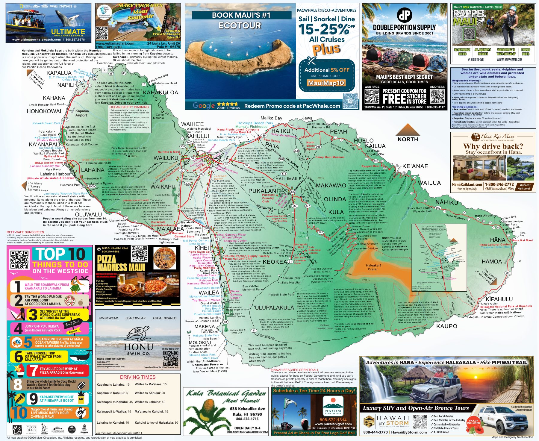
Page 1, the island map: all of Maui from Kapalua to Kīpahulu, with highway numbers, beaches, parks, lookouts, Haleakalā National Park and short notes on places along the way.
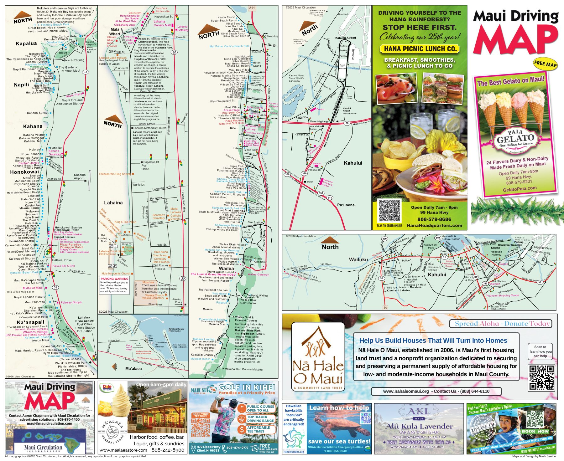
Page 2, the town maps: close-up street maps of
- Kapalua, Nāpili, Kahana, Honokōwai and Kāʻanapali
- Lahaina
- Kīhei, Wailea and Mākena
- Kahului Airport
- Kahului and Wailuku
- Māʻalaea Harbor
Maui driving times
Approximate times from the map, in minutes. Actual times depend on traffic.
| Route | Minutes |
|---|---|
| Kapalua to Lahaina | 15 |
| Kapalua to Kahului | 60 |
| Kāʻanapali to Kahului | 45 |
| Kāʻanapali to Wailea | 45 |
| Lahaina to Kahului | 40 |
| Wailea to Māʻalaea | 15 |
| Wailea to Kahului | 20 |
| Wailea to Lahaina | 40 |
| Māʻalaea to Kahului | 15 |
| Kahului to the top of Haleakalā | 80 |
Save it for offline use
- iPhone or iPad: open the PDF, tap the Share button, then Save to Files.
- Android: open the PDF and tap Download. It will be in your Files or Downloads app.
- The file is 12.5 MB, so download it on Wi-Fi before you set out.
- Zoom in on page 2 for street-level detail.
Prefer paper? Pick up a free printed copy from a brochure rack on Maui.
Own a Maui business?
Put it in front of visitors on the next edition of the Maui Driving Map.